Need data on drones flying in our air?
Airsight can provide you with comprehensive data on the drones that are flying in the air.
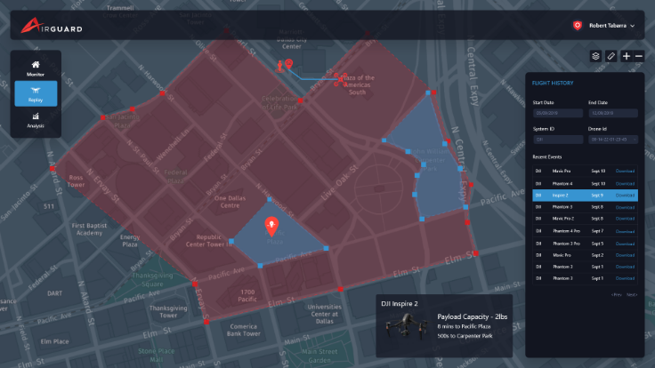
Datasets can include the following information:
- Drone GPS Location
- Drone Pilot GPS Location
- Drone Speed
- Drone Altitude
- Drone Flight Paths
- Drone Make & Model
Datasets are available mostly for law enforcement, intelligence agencies and military applications.
Request A Sample Dataset Today.
Airsight’s AirGuard system also offers an analytics module that you can embed or integrate with your software.
AirGuard’s analytics allows you to display the data in various forms like heatmaps, and gives insights like average flight duration, average altitude etc.


.png "Background (1)")