What is AirGuard?

Capabilities
of AirGuard
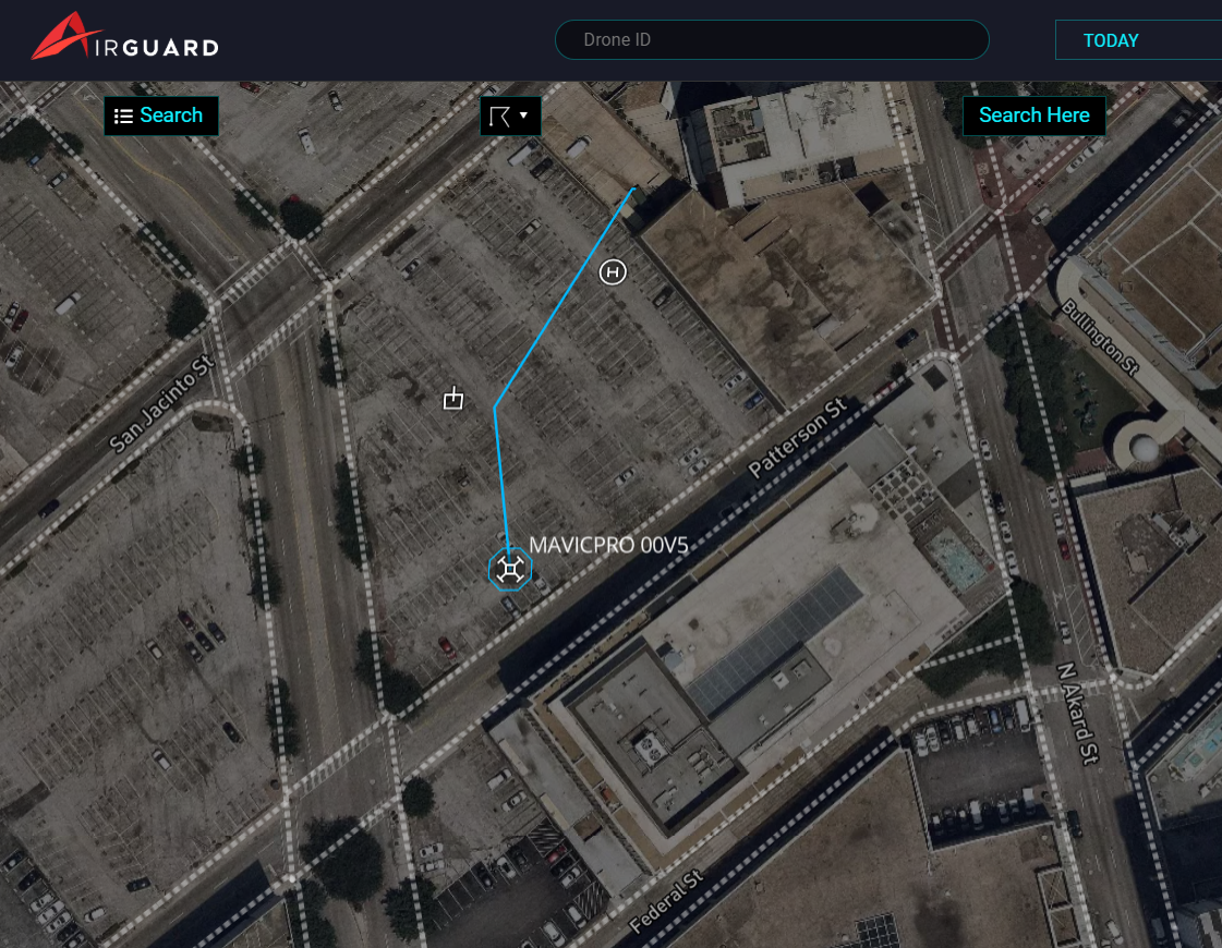
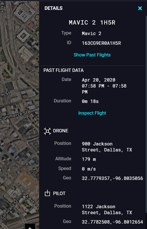
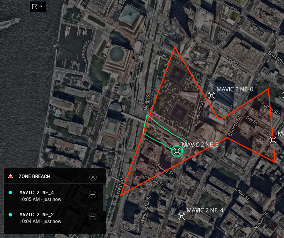
If a drone enters your area, AirGuard gives you Real-Time Data about the Drone GPS Location, Pilot GPS Location, as well as Drone data like Make and Model, Altitude and Speed.
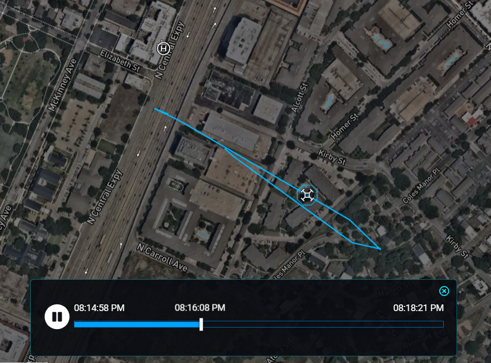
AirGuard has a robust Flight History & Playback feature, so you can access all past drone incidents.
AirGuard is scalable based on client requirements and budget. AirGuard can cover one site, multiple sites or even the entire city. It can utilize a single sensor or multiple sensors based on client’s security needs and budget.
Flight History & Playback
You can download the flight path video and all the drone information related of a particular flight to log as evidence.
GeoFencing & Alerts
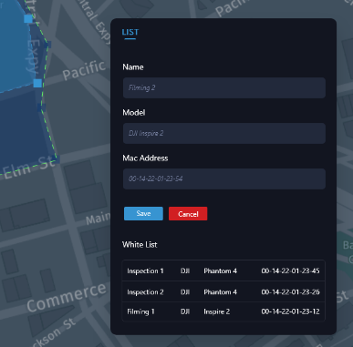
Whitelist & Blacklist
AirGuard also lets users blacklist drones that have been banned or marked as repeated offenders. create alert rules that allow them to track blacklisted drones outside their normal ‘Alert Zones’ giving them additional time to react.
AirGuard’s 4 Steps
to Secure your Airspace
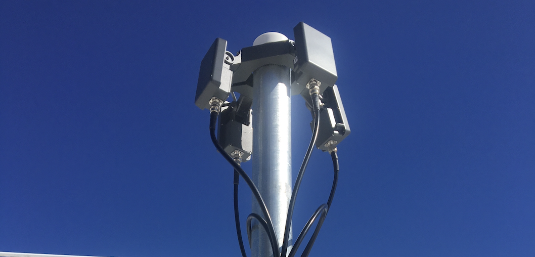
Hardware layers of the
AirGuard Drone Detection Software Platform
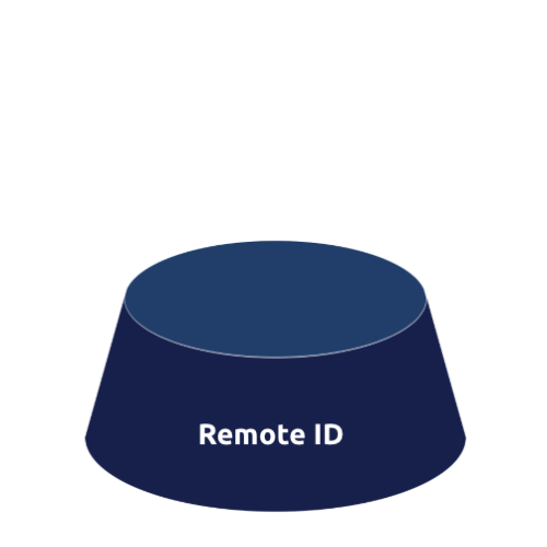
Remote ID
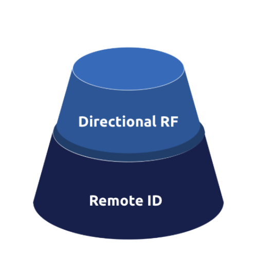
Expanded RF Detection
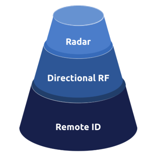
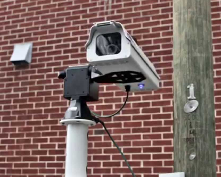
Radar with Visual Camera
How Does AirGuard help you respond to aerial drone threats?
AirGuard empowers your team to track both drones and pilots to respond proactively to threats before they can cause damage. Our solution provides real-time insights and customizable features that help secure your airspace, allowing you to make informed, data-driven decisions for enhanced threat response.
AirGuard empowers your team to track both drones and pilots to respond proactively to threats before they can cause damage. Our solution provides real-time insights and customizable features that help secure your airspace, allowing you to make informed, data-driven decisions for enhanced threat response.
-
Visualize the threat by distance.
-
Create warning and alert zones.
-
Create SOP based on actionable data.
-
Detailed flight path history.
-
Pilot historical location.
-
Special Interest location heatmaps.
-
Improve SOP’s based on Analytics and Data.
-
Integrate into other security systems.